
GeoAnalytics Engine now includes additional tools for performing geocoding and network analysis within environments like Databricks, Amazon EMR, Google Dataproc, or your own Spark cluster.
Network Analysis
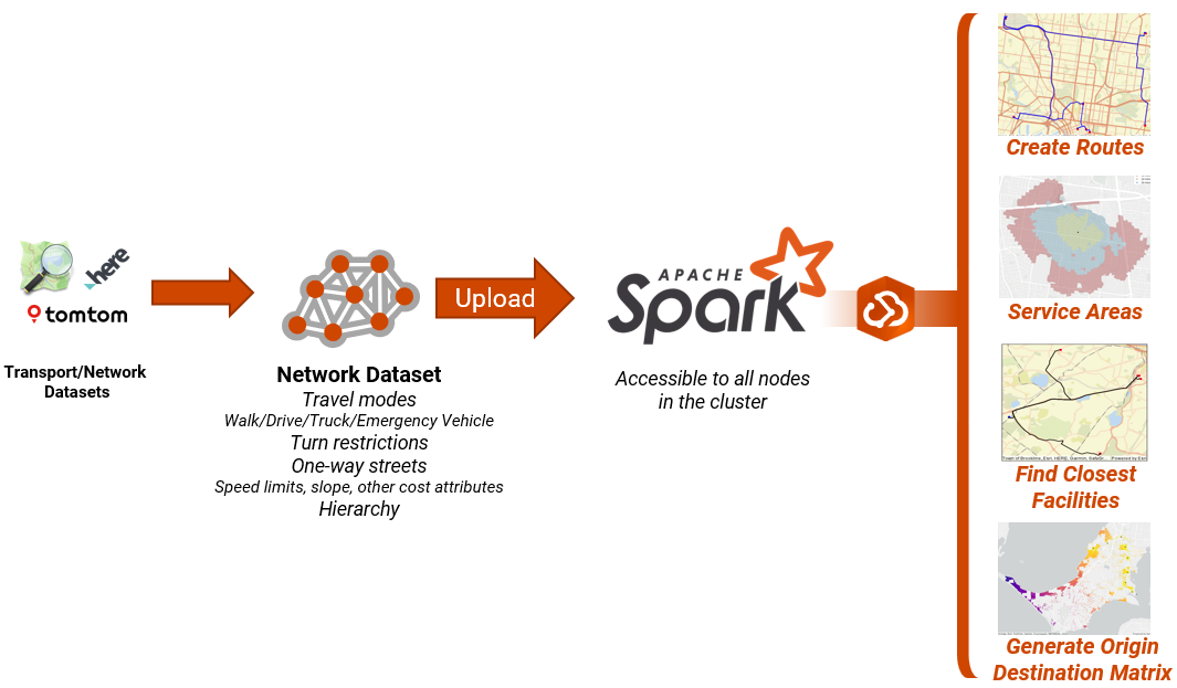
The network analysis tools require a network dataset (ND) so that they can model transportation networks. In my opinion, an Esri Network Dataset is the most accurate way of representing every aspect of a transportation network.
Where do you get a network dataset?
The GIS team may already have one, or have the skills to create one.
- Build one from OSM data – this includes taking the relevant tags from OSM for connectivity. This is
- Build one from Transport department open datasets – Can even use Geoanalytics Engine to help in the preparation process.
- Buy a commercial Network Dataset – various options exist – HERE and TomTom are common options in Australia.
This ND is uploaded so that it is locally accessible to all nodes in the Spark cluster. External API calls would severely slow down working with big datasets.
The geoanalytics-natives plugin also needs to be installed against your spark cluster for performing network analysis and geocoding.
What’s the problem?
Need big compute to solve big network analysis problems for multiple scenarios
If you’re a GIS analyst dealing with problem statements that require extensive network analysis across large areas of interest and multiple scenarios, you’ve likely experienced the challenge of waiting for progress bars to finish their job. I recall a project last year, where each scenario to calculate travel times to facilities for every address point in a capital city was taking at least 8 hours to run.
Need to accurately model transportation networks
If you’re a data scientist and you need to model a transport network, and need a sophisticated way of doing this that takes into account factors like turn restrictions, speed limits, hierarchy, travel modes for different vehicle types, weight and height restrictions, but you also can’t rely on an API for this, you need something that will allow you to perform batch operations that work entirely within your spark cluster – A network dataset combined with ArcGIS Geoanalytics Engine will help you. Calculating shortest length along a road dataset is not going to give you good results.
Tools & Use Cases
Generate OD Matrix
Creates an origin-destination cost matrix from multiple origins to multiple destinations, returning a table that contains the travel times/distance to each destination.

My personal favourite tool within the Network analysis toolset and very compute intensive and perfect fit for spark clusters.
Example Use Cases:
- Accessibility analysis – The 30 minute city. Understanding who has access to facilities and more importantly – who does not. These tools are already used for understanding accessibility to schools, hospitals, vacination clinics, etc.
- Emergency Response Allocation – Optimise where ambulances, fire stations are balanced across a region to serve its population
Generate Service Areas
Popular tool to generate reachable service areas around facility locations. For example, a 10-minute walk-time service area around a bank indicates a region where residents can walk to that bank within ten minutes
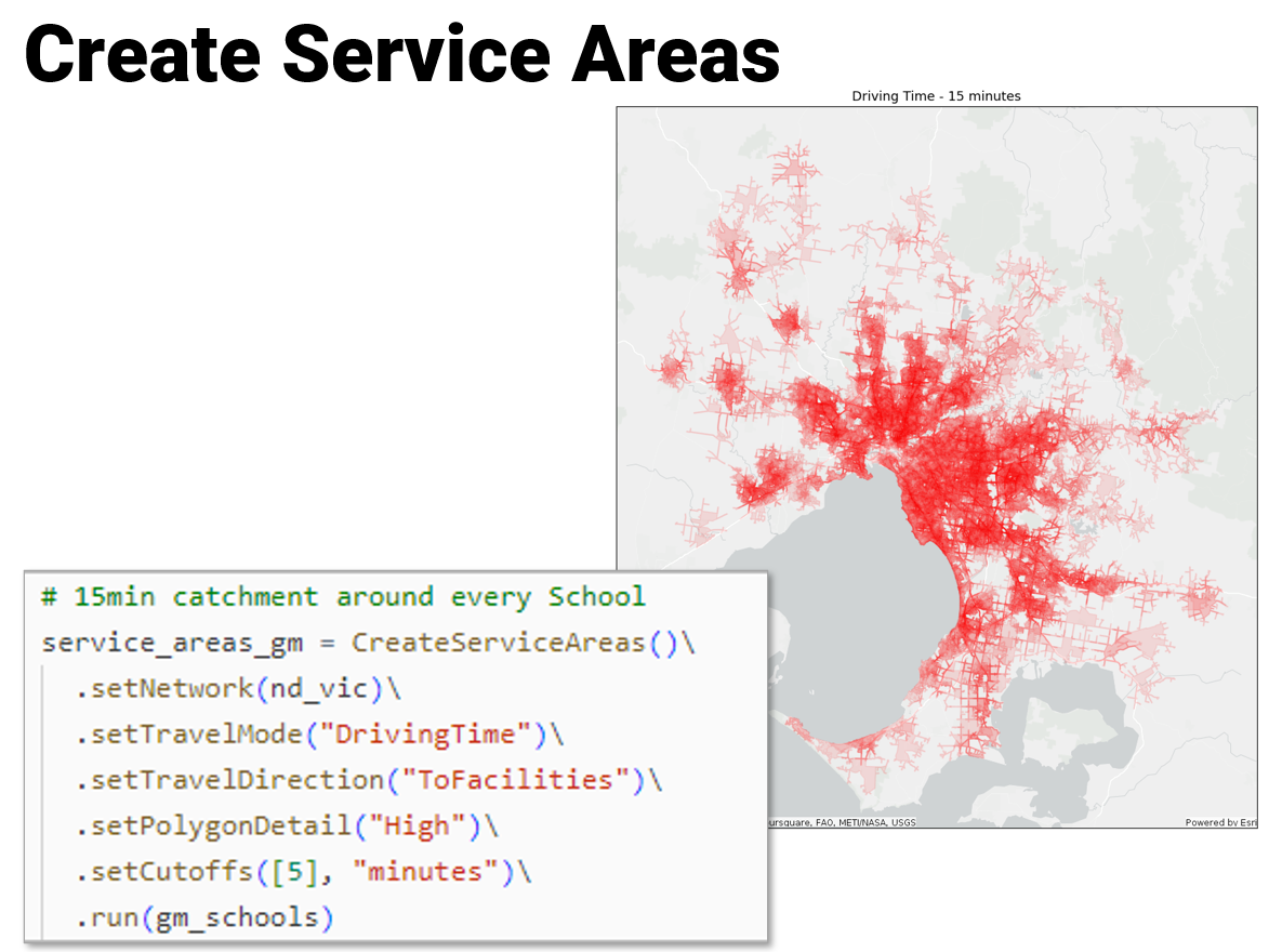
Example Use Cases:
- Analysing market coverage– Assess likely customers that will accecss your stores. Understand your customers behaviour and their willingness to travel to meet their needs.
- Site Selection – Assist in the decision making for choosing locations for new branches, stores, office locations, hospitals, etc.
Create Routes
The Create Routes tool finds the best route between a series of input points.

Example Use Cases:
- Site visit optimisation– A utility creates an optimized route daily for each of the crews to maximize the number of inspections performed each day, saving time and fuel.
- Travel Analysis – Look at past trip data to understand patterns and outliers.
With GeoAnalytics Engine enabling true Network Analysis in Spark environments is a powerful combination that should allow for more complex questions to be asked, and for data scientists to be empowered with unique spark native tooling.
